Urban Design Rendering: Visualizing Urban Projects Before Build
Discover how urban design rendering supports planning, marketing, and approvals through CGI, aerial visuals, and scalable urban visualization workflows.
.webp)
For developers managing multi-phase projects, municipality approvals, and investor presentations, urban rendering has become essential before construction begins. Large developments are difficult to communicate through technical drawings alone, especially when stakeholders must evaluate traffic flow, landscaping, public spaces, lighting, and architectural context simultaneously.
This article explains how modern urban design visuals help teams present large-scale ideas more clearly and improve communication across development, marketing, and planning workflows.
What Is Urban Design Rendering?
Urban rendering is the process of creating realistic visual representations of large-scale developments before construction begins. These projects often include residential districts, mixed-use communities, transportation systems, waterfronts, public parks, and smart city infrastructure. Unlike single-building visualization, urban rendering focuses on how architecture, roads, landscaping, lighting, and pedestrian movement function together across an entire environment.
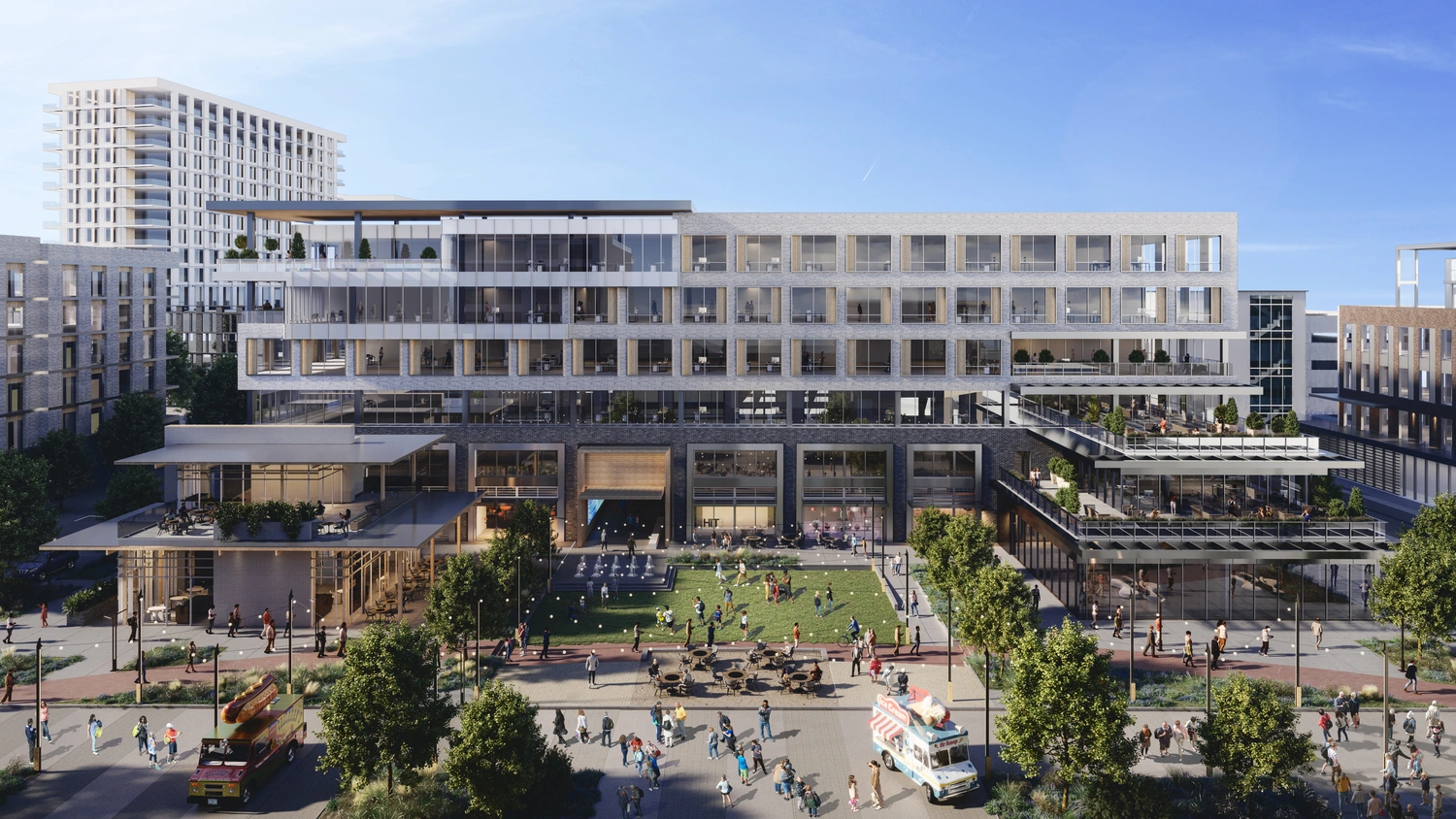
The role of CGI in urban development has expanded rapidly as municipalities, developers, and planning studios face growing pressure to communicate projects clearly during approvals and public consultations. A well-designed urban design render helps stakeholders evaluate scale, traffic flow, and public interaction more effectively. Technical plans alone rarely help investors or communities understand how a district will actually feel and function.
Modern urban planning rendering helps teams present traffic flow, public spaces, skyline integration, and environmental atmosphere through visuals that people can immediately understand. This is especially important for projects involving multiple stakeholders, phased construction, and large-scale marketing campaigns where consistent communication directly affects approvals, investor confidence, and long-term project momentum.
Why Urban Design Renderings Matter
Urban design renders help developers, municipalities, and planning teams communicate complex, large-scale projects more clearly during approvals, revisions, marketing campaigns, and public presentations. Key advantages include:
• Large urban projects often involve municipalities, transportation authorities, investors, developers, landscape architects, infrastructure consultants, and planning boards, making communication significantly more complex than standard architectural projects.
• Technical plans may work for architects and engineers, but investors and public stakeholders usually need visuals to understand scale, density, pedestrian flow, and public interaction.
• Urban design renderings support municipality approvals by helping planning departments evaluate zoning updates, infrastructure changes, transportation systems, and environmental integration faster and more clearly.
• For developers, urban CGI has become a major marketing asset, especially for mixed-use and phased developments where investor confidence and pre-sales directly affect financing.
• Cities increasingly use urban design visuals during public consultations to explain traffic impact, green spaces, pedestrian movement, and neighborhood integration.
• Updating a digital urban design plan rendering is far faster than rebuilding physical models or redesigning large presentation packages during revisions.
• The teams that move projects forward fastest are usually the ones that communicate ideas clearly, consistently, and early in the approval process.
As urban projects become larger and more complex, clear visual communication has become just as important as technical planning itself. Strong urban render helps teams reduce approval delays, improve stakeholder understanding, and keep large developments moving forward more efficiently.
Types of Urban Rendering
Aerial Urban Renderings
Aerial renderings help developers present district scale, transportation systems, building density, and environmental context during investor presentations and municipality approvals.
Street-Level Renderings
Street-level urban renders focus on pedestrian experience, storefront visibility, landscaping, public lighting, and walkability. These visuals are widely used for hospitality districts, mixed-use developments, and waterfront projects.
Masterplan Visualization
Masterplan visualization communicates zoning organization, green areas, infrastructure, and architectural distribution across large developments. Planning teams often use these visuals during approvals and public consultations.
Public Space Rendering
Public space rendering helps landscape architects and municipalities visualize parks, plazas, recreational zones, and pedestrian gathering areas before construction begins.
Infrastructure and Transportation Rendering
Infrastructure urban rendering supports roads, transit systems, rail networks, bridges, and pedestrian circulation projects, all of which require coordination among planners, engineers, and municipalities.
Nighttime Urban CGI
Nighttime urban CGI demonstrates architectural lighting, signage visibility, safety, and atmosphere after dark, especially for hospitality and entertainment districts.
Urban Animation and Flythroughs
Urban animations and flythroughs help stakeholders understand project scale, circulation, and spatial relationships more clearly than static visuals alone.
Interactive and Real-Time Visualization
Interactive urban visualization allows teams to review multiple phases, layouts, and updates dynamically while keeping every urban design render consistent across large-scale planning workflows.
.webp)
Industries That Use Urban Visualization
Urban visualization supports a wide range of industries beyond architecture alone.
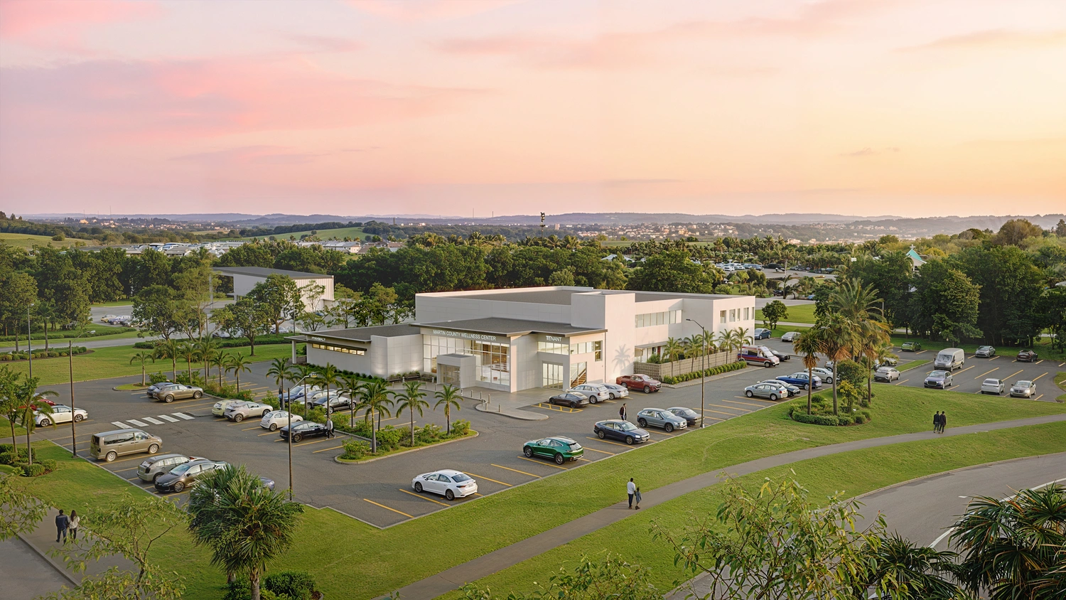
Real Estate Development
Developers use urban design renders for investor presentations, pre-sales marketing, project approvals, and advertising campaigns. Large residential and mixed-use developments often require dozens of urban design renders across different project phases.
Architecture Firms
Architecture studios use urban visualization to communicate master plans, district layouts, public interaction, and contextual integration. These visuals help firms present ideas more clearly during competitions and stakeholder reviews.
Urban Planning Studios
City planning professionals use urban planning rendering to evaluate zoning strategies, pedestrian circulation, transportation systems, and environmental integration.
Municipal Projects
Municipalities increasingly rely on renderings during public consultations and city planning approvals. CGI helps communicate future infrastructure changes in a way the public can immediately understand.
Infrastructure Companies
Transportation and infrastructure firms use renders for transit hubs, bridges, roads, rail systems, and public mobility projects.
Landscape Architecture
Landscape architecture studios use urban design renderings to present parks, public plazas, waterfront spaces, and pedestrian environments.
Smart City Initiatives
Smart city projects often involve extremely complex systems, including mobility networks, public technology, environmental monitoring, and energy infrastructure.
Scalable urban render workflows help teams maintain consistent visuals across presentations, animations, and planning materials.
Urban Rendering for Real Estate Marketing and Public Presentations
Urban design visualization has become one of the most important communication tools for developers, municipalities, and planning teams managing large-scale projects before construction begins.
• Investor presentations are one of the most common applications of urban design rendering services. Realistic CGI helps developers communicate project scale, transportation access, public amenities, and commercial potential far more effectively than technical plans alone.
• Planning commission meetings often rely on realistic urban CGI to evaluate pedestrian circulation, landscaping, zoning integration, and building density during approvals.
• Public consultations have become another major use case, especially for mixed-use districts, waterfront developments, and large residential communities where stakeholders need to understand how projects may affect traffic flow and neighborhood identity.
• Large developments frequently require dozens of visuals across websites, brochures, sales centers, and outdoor advertising. A professional urban design rendering company helps maintain visual consistency across marketing materials and multiple project phases.
• Many developers also combine urban 3D with property visualization workflows when marketing hospitality projects, villas, residential towers, and phased urban masterplans.
Strong urban CGI reduces confusion, speeds up approvals, and helps projects maintain momentum across investors, municipalities, and public stakeholders simultaneously.
Traditional Urban Visualization vs. Modern CGI
For large urban developments involving multiple approvals, investor presentations, and public consultations, visualization workflows directly affect how quickly projects move forward. The table below compares traditional planning methods with modern urban CGI workflows used in large-scale development communication today.
Traditional methods still play an important role during planning and engineering stages. However, large urban projects now require faster and more scalable communication tools. Modern CGI allows teams to update landscaping, lighting, traffic flow, and public-space layouts without rebuilding entire presentation packages.
This becomes especially important during projects involving multiple stakeholder reviews and phased approvals. One base 3D environment can generate aerial visuals, street-level scenes, animations, nighttime renders, and marketing assets simultaneously.
The teams that maintain project momentum are usually the ones that communicate large-scale ideas clearly, consistently, and early enough to reduce approval delays.
How to Choose an Urban Design Rendering Company
When evaluating urban visualization partners, teams should focus on factors affecting quality, scalability, and approval efficiency:
• Choosing the right urban rendering studio requires more than reviewing a few attractive images. Large urban projects demand scalable production systems, technical coordination, and consistent communication across many stakeholders.
• Portfolio quality should always be evaluated first. Look for studios with experience handling large environments, infrastructure complexity, realistic lighting, environmental context, and multi-phase developments.
• Scalability is equally important. Some studios create strong single visuals but struggle with larger production volumes involving multiple viewpoints, animations, revisions, and marketing assets.
• Technical expertise also matters. Urban design render workflows often involve GIS data, CAD integration, transportation systems, environmental planning, and complex architectural coordination.
• Communication workflow is another major factor. Most project delays happen during revisions and stakeholder approvals rather than in production itself. Studios with organized review pipelines usually help projects move faster.
• Turnaround time should also be evaluated realistically. Fast production only matters when visual consistency remains stable across all deliverables and project phases.
• Strong urban design renderings are not just technically accurate. They must communicate atmosphere, scale, usability, and public interaction clearly enough for investors, municipalities, and communities to understand immediately.
Why Choose PIXREADY for Urban Design Rendering Services
PIXREADY helps developers, architects, and planning teams communicate large-scale urban projects more clearly across approvals, investor presentations, and marketing campaigns. Key advantages include:
• Experience with complex urban visualization projects
• Photorealistic CGI built around real-world context and scale
• Scalable production pipelines for large developments
• Hybrid 3D + AI workflows that accelerate revisions and content production
• Business-focused visualization for approvals, fundraising, and marketing
• Fast turnaround while maintaining consistent visual quality
• Flexible collaboration with architects, developers, and planning teams
• Consistent storytelling across aerials, street views, animations, and presentations
• Recognized through international architecture design awards for high-end CGI and visualization excellence
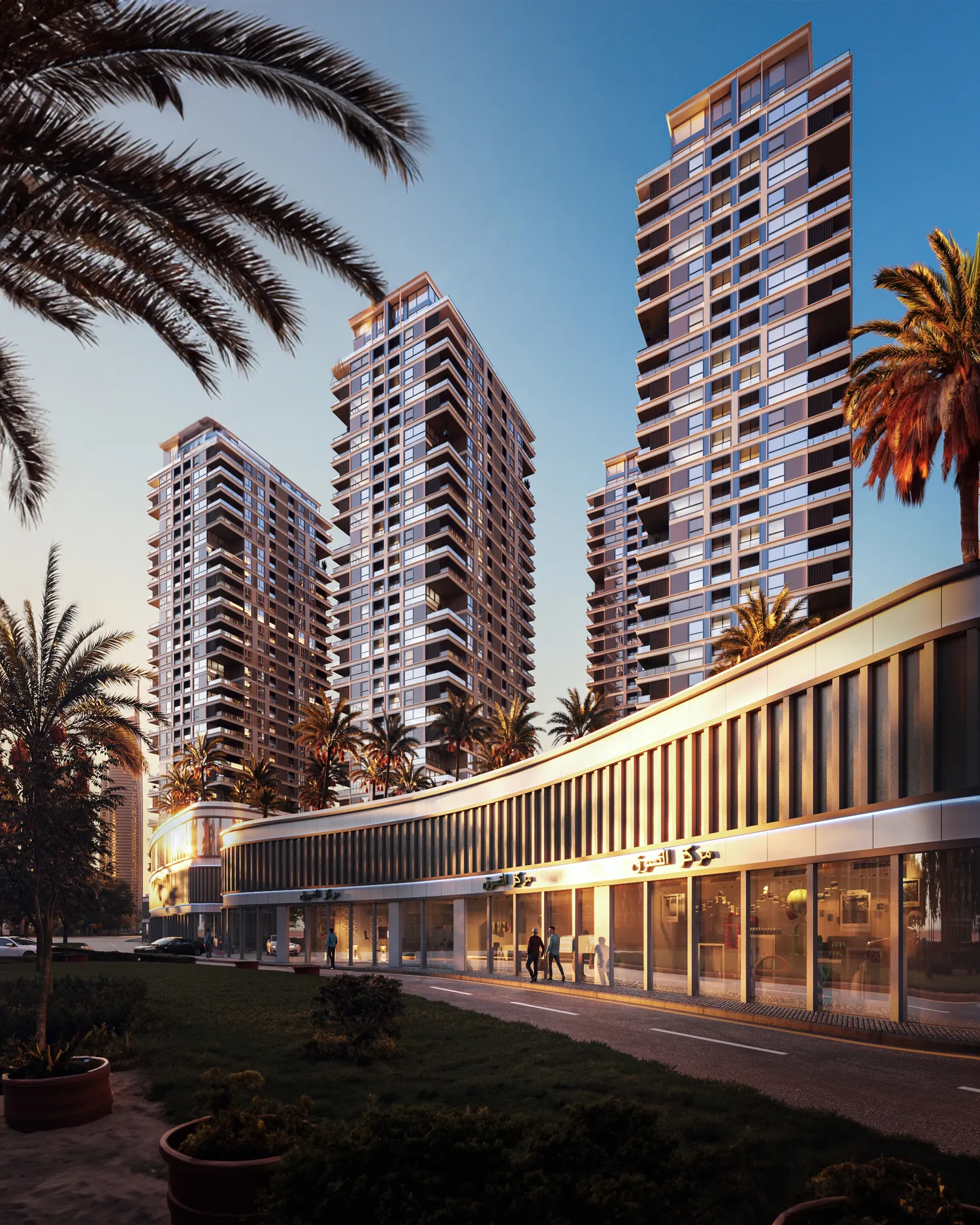
A leading architectural consultancy in Dubai partnered with PIXREADY to visualize a large residential development designed around comfort living and modern urban renders. Using architectural drawings and project references provided by the client, our team created five detailed 3D exterior renderings showcasing residential buildings, landscaped recreational zones, pedestrian areas, and commercial spaces.
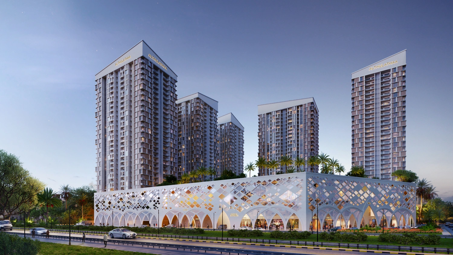
The visuals were developed to support investor presentations and communicate the atmosphere and scale of the project before construction began. By transforming technical plans into realistic CGI, PIXREADY helped investors better understand the development’s potential, making presentations clearer, faster, and more persuasive during early-stage investment discussions and approvals.
PIXREADY developed this bionic public landmark concept as an internal exploration of hybrid AI + 3D architectural visualization workflows and experimental urban design render production. The project combined AI-driven ideation with production-grade 3D modeling to test how expressive architectural forms could remain realistic, scalable, and structurally coherent. Early-stage concepts were generated using AI tools, then refined through sketches and rebuilt in Autodesk 3ds Max for precise geometry and architectural consistency.
Additional AI-assisted workflows helped create an environmental atmosphere, lighting variations, and an urban context. The final project included high-resolution CGI visuals and an animated fly-through sequence. The concept later received Platinum Winner recognition at the International Architecture & Design Awards 2026.
Conclusion
Urban design rendering has become one of the most effective communication tools for large-scale development projects. Strong urban CGI helps developers, architects, and municipalities explain complex ideas more clearly, streamline approval processes, support investor communication, and scale marketing production before construction begins.
As urban projects become more complex, teams that communicate ideas faster and more consistently usually move projects forward more efficiently. PIXREADY creates scalable urban visualization for approvals, marketing, and planning workflows.
Get 3d expert on your side
More than a 3D rendering vendor, PIXREADY acts as a strategic CCI partner helping brands
сreate scalable visual content for marketing, sales, and product launches. Let's explore your
project and discuss how CGI can support your business goals!

Stas Dunaevskiy is an Account Manager and Business Development Specialist at PIXREADY, a company focused on scalable CGI production and architectural visualization. He helps clients explore the possibilities of cutting-edge CGI technologies, with a special focus on immersive 3D walkthroughs, virtual tours, and architectural visualization. He has worked with real estate developers, construction companies, and product manufacturers, guiding them toward solutions that bring their projects to life and support business goals. With his consultative approach, Stas ensures that each PIXREADY project combines creative vision with the latest advancements in 3D visualization.


